Last time I wrote that “adjusting to field camp has been pretty easy. The Marines prepared me well for this physically demanding and highly structured environment.” Easy might have been the wrong word. Being physically fit and super organized, I might make it look easy, but beneath my calm exterior, my mind is clouded by doubt. The reason I’m so well prepared is because I worry about everything.
I served on active duty for four years. One of the hardest things about readjusting to civilian life has been travelling with others in unfamiliar environments, which is exactly what I’ve been doing for the last four weeks of field camp. I get stressed because I feel the need to plan everything. The Marine Corps taught me that the more control I can have over my surroundings, the safer I will be. When I’m on my own, this is not a problem. I can take all the time I need to properly prepare for whatever the day may bring. When I’m travelling in a 30-person school group with instructors who decide where we go and when we stop, I worry endlessly.
What if my boots don’t dry overnight? What if I forget to refill and pack the water bottle I was using at breakfast? Once we’re out in the field, what if I don’t have time to stop and reapply sunscreen? What if I need to adjust my pack? Will there be a lunch break? When, and for how long?
Whenever I’m away from home, I feel the need to be at 100% readiness so that if an emergency presents itself I will be in the best possible position to respond. Call me paranoid, but that’s the way I think. I’ve been trained to be highly aware of my vulnerabilities. Stopping and addressing them calms me down and gives me a surge of confidence, but it’s hard to find the time to do that at field camp. I have to rush to keep up because my group is always on the move.
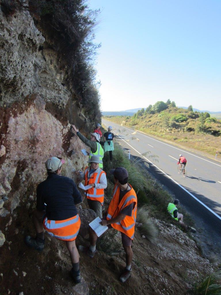
Often road cuts reveal fascinating outcrops. This is a cut in half hummock (bump-shaped mound) several kilometers from Mt. Ruapehu. Its jumble of boulders mixed with fine sands and every grain size in between are what we would expect of an avalanche debris deposit that could have formed after a crater collapse.
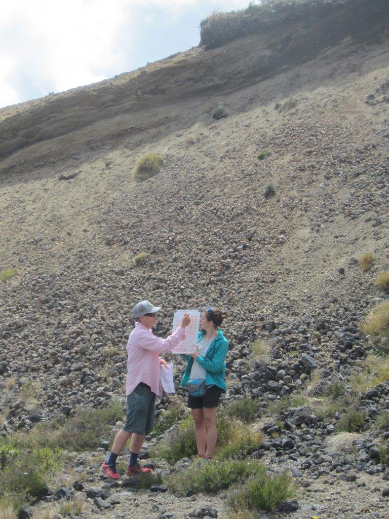
Breaking out the whiteboard turns this small cinder cone volcano into an outdoor classroom.
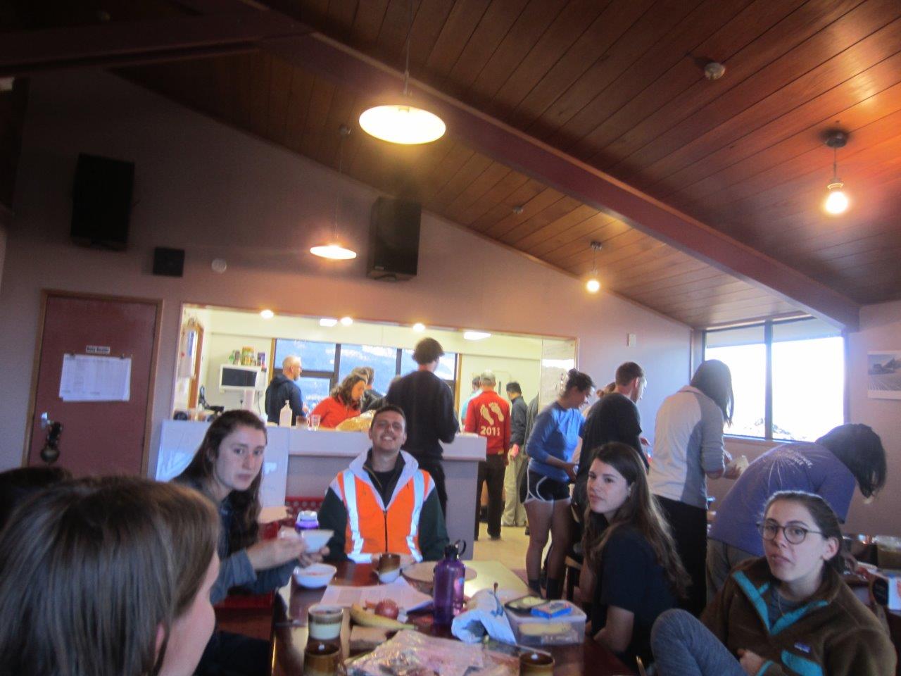
There’s a lot going on in this little ski cabin. Students eat breakfast in the foreground, wash dishes in the background, and prepare lunches off to the side. Getting around requires a lot of patience, because there are always people in the way.
We spent nine days in New Zealand’s Southern Alps, five days on the West Coast, and now here we are on North Island. We’ve spent all week in the Taupo Volcanic Zone studying volcanoes. Highlights have included hiking the famous Tongariro Alpine Crossing, speaking with volcanologists at the Institute of Geological and Nuclear Sciences, and getting to put our hands on volcanic deposits left over from processes like lava flows, pyroclastic density currents, and lahars. All the while we’ve been staying at a cozy, but cramped ski lodge on the flank of the Zone’s tallest volcano, Mt. Ruapehu, which last erupted in 1995.
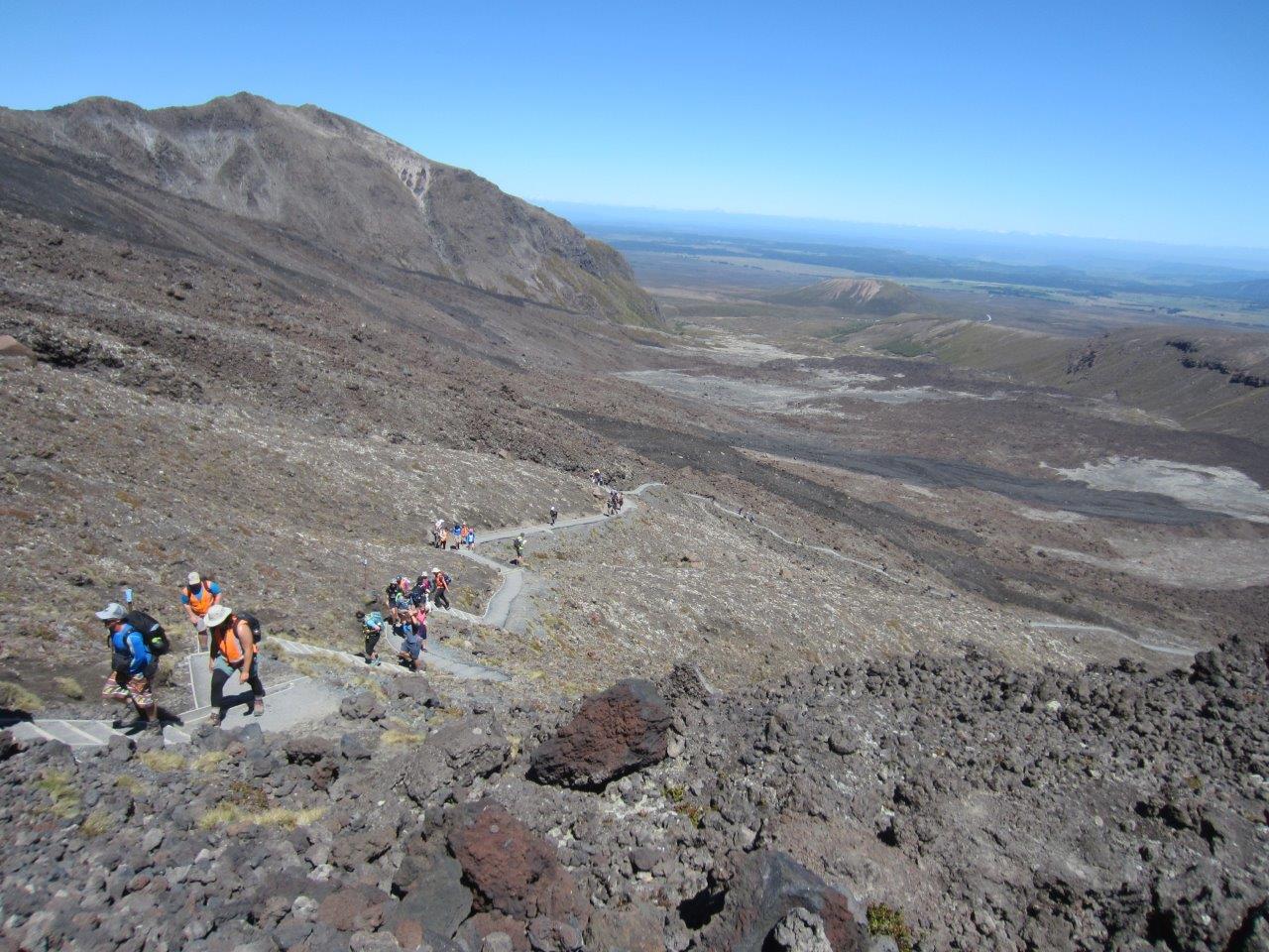
The 19.4 km Tongariro Alpine Crossing is more easily completed from the north end of the trail. From that direction, it requires only 700 meters of elevation gain vs. 1100 meters if attempted from the south. Still, it’s steep in places. Here the trail zig-zags its way past an old lava flow (foreground).
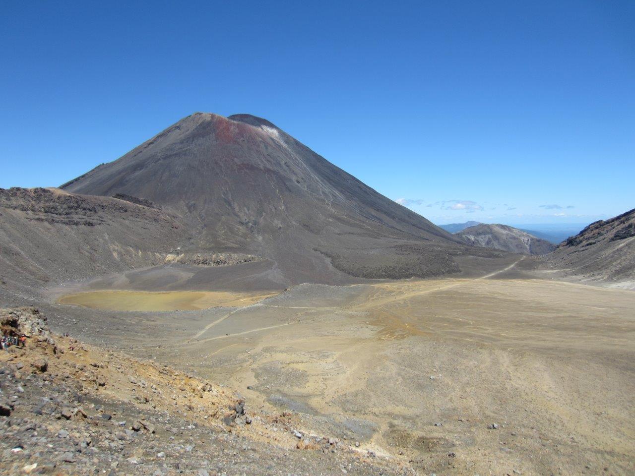
Once you make it up that first steep bit you cross an ancient lake bed. Mt. Ngauruhoe (AKA Mt. Doom from the Lord of the Rings films) looms ominously overhead.
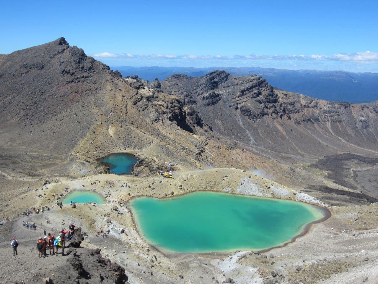
Now past the high point on the trail, we look down at our first big descent. Beneath us are a trio of geothermally heated pools that smell of sulfur. Notice the yellow helicopter that just landed on the ground between the pools. The Tongariro Alpine Crossing hosts thousands of hikers every year, many of whom are either unlucky or inexperienced. During the summer (which is now in the southern hemisphere) an average of one hiker is rescued every day.
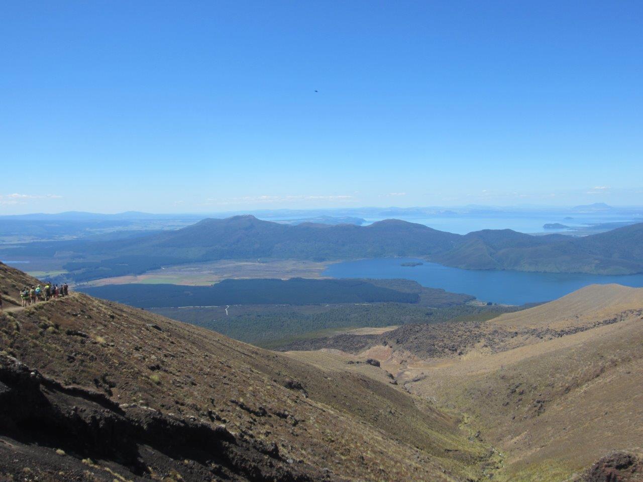
This is the last good view we got on our way down the crossing. Lake Rotoaira is in the middle ground and the much larger Lake Taupo is in the background. Lake Taupo fills the caldera of a super-eruption that happened 26,000 years ago. It was a cataclysmic event with global consequences. Five hundred thirty cubic kilometers of magma were erupted. (Imagine something with the footprint of Manhattan, but six miles thick!)
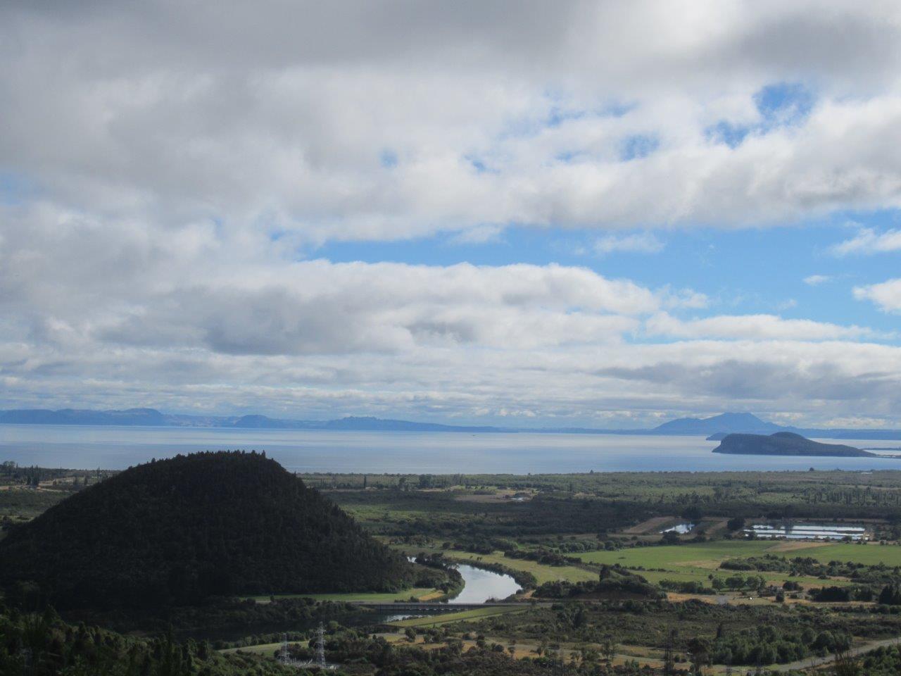
This close-up gives a better sense of appreciation for just how large Lake Taupo is. The bumps you see in the foreground and middle ground are small rhyolitic domes that have formed since the supereruption 26,000 years ago.
Tomorrow we fly back to Christchurch for the final module of this field camp: a mapping exercise on Banks Peninsula. For all my anxiety, I must admit, it doesn’t get much better than hands-on learning in world-class geological settings. Experiencing these rocks and sediments with all five senses (yes, sometimes even taste*) is sure to cement them in my memory better than any textbook figure. Still, I’ll be happy when it’s done. It will be good to set my schedule and move at my own pace.
*Even with a hand lens, it is impossible to see the difference between silt and clay in the field. Try grinding them between your teeth, however, and the difference is night and day. Clay is so fine you won’t feel a thing, but silt is coarse enough that it will feel similar to sand.
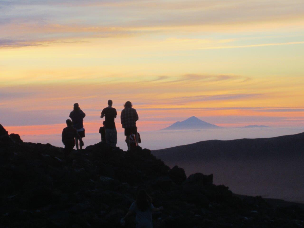
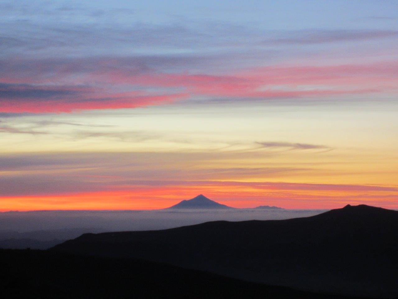
The sunsets here are spectacular. Several students admire Mt. Taranaki 150 km to the west.
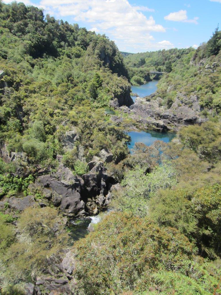
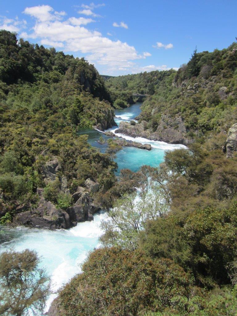
Before and after images of Waikato River as Arataitai Dam releases millions of gallons of water to generate hydroelectric energy.
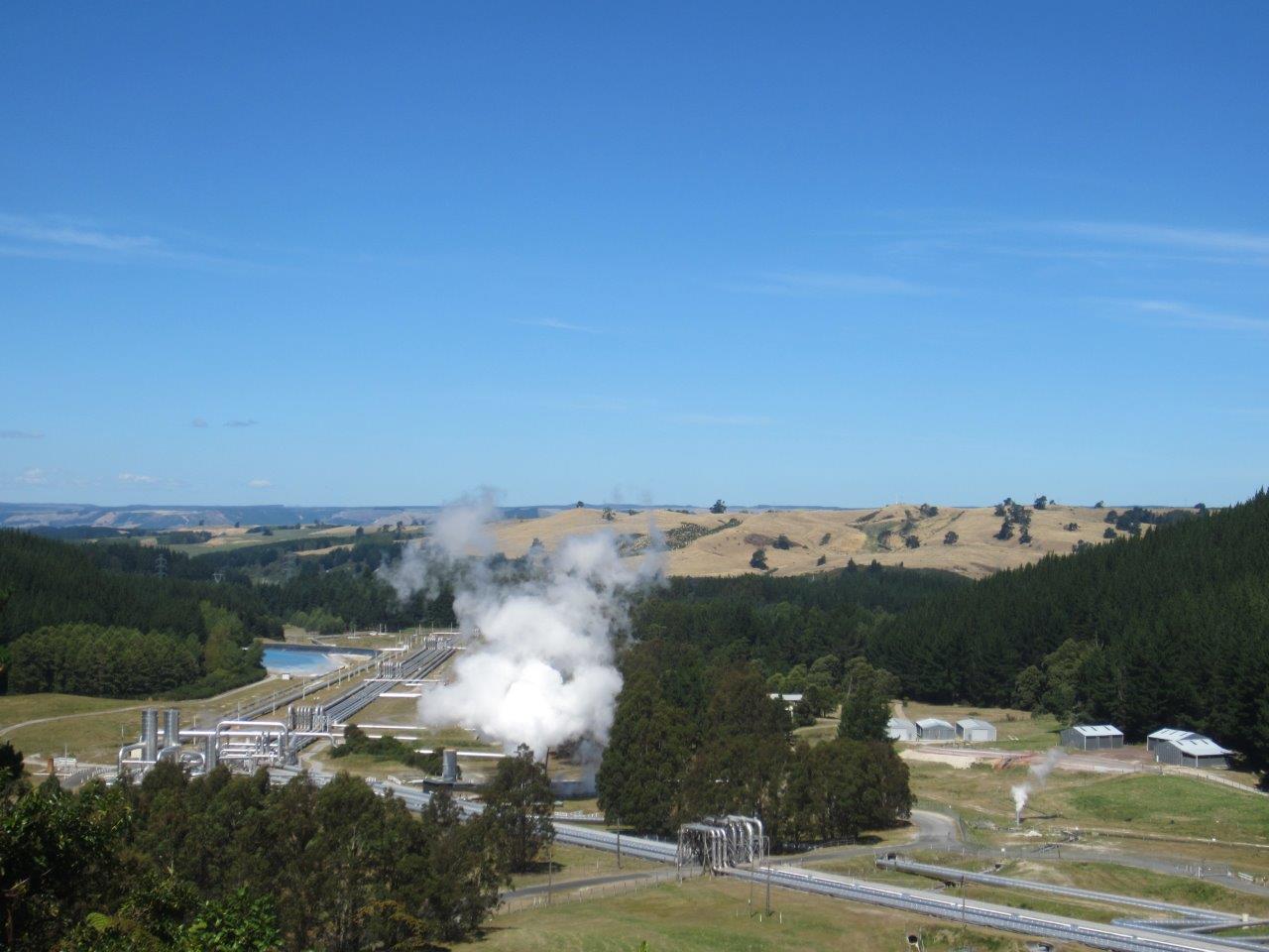
A geothermal power plant near Lake Taupo that dates back to 1958 and is still in operation. New Zealand gets about 80% of its energy from renewable sources.